Rising: Dispatches from the New American Shore
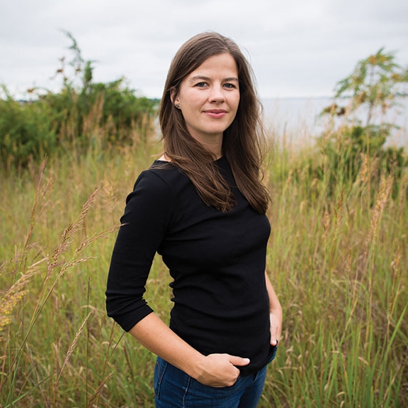
Coastlines are drowning. Elizabeth Rush ’06 investigates the devastating impact of climate change on coastal communities in a stunning new book of literary reportage.
Sometime during my first week on the Louisiana bayou, I walk to the Isle de Jean Charles. The Island Road, built in the early fifties right after the first oil rig went in, runs eight miles southwest from Pointe-aux-Chenes out between two expanses of water so new that neither has a name. Since the little remaining land is incredibly flat, the sky’s extravagant clouds serve as a sort of alternative to topography. Hoodoo-shaped cumulus formations hug the horizon, where a storm is fixing to start. Snowy egrets dig in the few remaining bayou banks, and mullet throw themselves out of the water as the first dime-size droplets of rain fall. Less than halfway to the island, my gut confirms what I already know from my research. This is a world unto itself, coming undone.
Just fifty years ago, the surrounding geography was complex and interconnected—a network of lakes and marshes that were navigable in flat-bottomed boats called pirogues. If you didn’t have a boat, you could walk between places by sticking to the higher ground abutting the arterial bayous. This word, bayou, sounds French, but it is actually Choctaw in origin. It means “slow-moving stream.” Today it is used in a general sense to describe Louisiana’s rare riparian coast, even though the bayous themselves are disappearing. The natural ridges and pathways that the Choctaws used to travel are going with them. Nearly every defining feature has been replaced by a single element: salt water. The loss is pronounced enough that a few years ago the National Oceanic and Atmospheric Administration had to remap the nearby Plaquemines Parish and in so doing removed thirty-one place-names. Yellow Cotton Bay, English Bay, Cyprien Bay, Dry Cypress Bayou, and Bayou Long; none of these individual bodies of water exist anymore. The wetlands that once gave them shape have disintegrated, making the bayous and bays indistinguishable from the surrounding ocean. “Maybe you could swim,” the owner of the Pointe-aux-Chenes marina tells me when I ask if I can get to the Isle de Jean Charles without a car. “But I wouldn’t, on account of the gators. Better just to take a right off of Highway 665 and stick to the Island Road.” Behind him stands a fifteen-foot-high statue of Jesus. The martyr’s body is lank and lean, his arms outstretched toward the watery expanse. Next to the statue a dead cypress tree looms. Its empty branches mirror the man’s sacrificial gesture. It too has passed beyond the barest version of itself into death. Its roots soaked in salt.
■ ■ ■
The film Beasts of the Southern Wild, a postapocalyptic tale of a band of homesteaders who survive a fierce storm and eke out a living in the drowned world that follows, was shot on the island and is based loosely on the lives of those who still reside out there, many of whom identify as Native American. I remember watching the film and thinking it remarkable that I was seeing environmental destruction bringing a community closer together instead of breaking it apart. I wanted desperately to know what that might look like in real life. This was long before I moved to Rhode Island, long before I saw my first dead tupelo, but after my initial trip to Bangladesh. It was the summer of 2013 and I was looking for proof of the rise in the United States, so I flew to Louisiana.
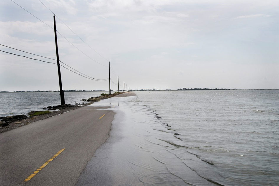
When Benh Zeitlin, the director of Beasts, told me that the island “felt like the end of the world,” I wasn’t sure if he was speaking of its remote location or of something less literal. The farther I amble out the single-lane highway to Jean Charles, the more I realize that both explanations make sense. The Isle de Jean Charles is where North America’s immense solidity ends, the frayed fingers of fine tidal lace splaying seaward. It is also possible to catch a glimpse of the future out here, of a world where the ocean covers what we used to think of as the coast. That is because over the past sixty years the wetlands that once surrounded the Isle de Jean Charles have all drowned, the rate of accretion trumped by land subsidence, erosion, and sea level rise. When I squint, it is difficult to tell just where the Island Road ends and where the water begins.
A man in a black pickup slams on his brakes and rolls down his window. “There’s gonna be some rain. Need a ride?” he asks, leaning back against the cab’s cracked leather and pulling at the brim of his baseball cap.
“I’m just walking out to the island,” I answer. This doesn’t clarify matters for him, so I add, “I’m OK,” and shake open my umbrella. He shrugs, rolls up his window, and keeps driving in the other direction, back toward Houma and firmer ground.
I repeat the phrase I’m OK in my mind as I walk along the rock-lined road. Three nights before flying to Louisiana, I fled the apartment I shared with the man I was to marry. For months I had sensed that this was not the relationship that would buoy me through the long passage that is adulthood, but I resisted leaving because there was still love, if fraught, between us. Eventually the levee of my optimism broke, and I stuffed my rolling suitcase with clean underwear, empty notepads, and a tent. It is not the first time, nor the last, that I turn my back on something I care about immensely. Though it is the first time it feels like a form of deceit.
Soon the road makes a sharp left along the highest and most stubborn spine of land. Two miles long and a quarter mile wide, this is what remains of the Isle de Jean Charles. Less than half a century ago, the island was ten times larger. Waterfowl marshes surrounded this chenier, or wooded ridge, atop which hundreds of residents built their lives. Now many of the homes that flank the Island Road sit on sixteen-foot-high stilts. Briars billow from the windows of those remaining on the ground, undoing the frames one growing season at a time. The ratio looks like one-to-two: for every lifted house there are two abandoned ones. For every person who has stayed, two are already gone.
Out toward the island’s tip, a man sits underneath his raised home enjoying the storm wind, backlit in the bruised light. As I walk past he hollers, “Get off this island!” Behind me a minivan crawls by, and the driver cackles from her window. “You leave!” she heaves in response. I am relieved that neither is speaking to me. The wheels of her Toyota Previa crunch across broken bits of blacktop as she pulls into the driveway next to one of those deflated swimming pools that look like big blue doughnuts. Now, I decide, is as good a time as any to start endearing myself to the people who still live out here. I turn and head toward the house, cantilevered up over the surrounding remnants of marsh. Much to my surprise the seated man says, “You must be Elizabeth.”
“Well, then, let me guess. You’re Chris Brunet,” I reply as I step onto the poured concrete slab that serves as his porch. He is the only islander who returned the calls I made in the weeks leading up to my trip. We had hatched a plan to have lunch on Friday, before I got it in my mind to walk out to the island a day ahead of schedule.
“I wasn’t expecting you out here until tomorrow.” Chris braces his arm against the seat of an adjacent wheelchair, throws his weight forward, and twists into place. He was born with cerebral palsy but it hasn’t slowed him down much. We shake.
“I must be pretty lucky to run into you,” I say. “I haven’t seen anyone else on the island all afternoon.”
“I don’t tend to go far,” Chris replies. A horsefly circles his head like a ball on a string. “And you just missed Theo, down the way. I saw him drive past in his pickup a bit ago.” He must have been the man who offered me a ride.
The woman in the van is Chris’s sister Teresa. She shakes my hand and walks over to the refrigerator, where she unloads an armful of soda pop, sweetened tea, and bottled water.
“I’m starting to get a feel for the place. It’s awfully pretty,” I say.
“Even prettier at sunrise and sunset,” Chris adds, pushing up the sleeves of his cotton baseball jersey. “You can’t say nothing about this here island until you see both. When it lights up the sky—putting the clouds in different colors—well, I don’t know how much you’d pay to see that on a vacation somewhere.” He picks up a yellow vinyl chair and rolls over to offer me a seat.
Chris’s nephew Howard—whom Chris took in a few years back, along with Howard’s sister, Juliette—is fishing in the channel behind the house. In 1951 the first oil rig was installed nearby, and with the rig came “channelization,” the digging of access routes through the marsh. The oil companies were supposed to “rock” each channel—to backfill it—when the rigs left, reducing the movement of water through the fragile marshland that surrounds and supports the bayous. “But they didn’t do that, they didn’t maintain the bayou like they said they would, and now the gulf is at our back door,” I was told in town. Every year, thanks to erosion, the channels grow wider, eating into the land that once comprised Jean Charles.
Just then, a dolphin swims up the man-made waterway, past the spot where Howard is casting his line. For a second I find its undulating fin thrilling.
“Forty years ago you would have never seen that animal all the way up here,” Chris says. “But the land is opening up all around us. The cuts they made in the marsh speed up the process. What was once sweet water is now salt, so these dolphins, they come in.” The entire time that humans have inhabited these bayous, it would have been unimaginable to find a big marine mammal so far “inland.” Then again, this island isn’t inland anymore.
While the dolphin is not direct evidence of sea level rise, its sudden appearance does point to a dramatic shift over time. It is a shift that Chris, who has lived here his entire life, can perceive and that I, as a visitor, cannot. My initial thrill settles into some other emotion. I think if I look at that dolphin long enough, fix my gaze on its body nosing north, I will once again be able to see—as I did with Faharul’s limp mustard plants—what is largely invisible to anyone who moves as often as I do: the hallucinogenic transformation of our coastline, the salt water kneading in—into the aquifer and root systems, into our backyards and basements and wildlife refuges and former freshwater creeks—a change so large it unsettles our very ideas of who we are and how we relate to the land we have long lived atop.
“Is there some single thing that you saw that made it clear to you that the environment was changing, and not just in a normal way?” I ask Chris. “Like that dolphin. When did you see your first one?”
“I don’t know, maybe fifteen years ago,” he says, scratching his graying goatee. “But you have to know that the thing that makes this saltwater intrusion so damaging now is that it’s close to home. Yes, we get dolphins up here, but the worst destruction is taking place in our communities.” He pauses, unsure of how to go on. Teresa fills the silence by offering me an Arizona iced tea. It seems to me that what Chris can’t quite put his finger on is that the dolphin is just a symbol. For me the symbol is environmental; I can point to it and say, This is evidence that the ecosystem is in flux. But for Chris the dolphin represents the slow disappearance of his neighbors. Over the past forty years nearly 90 percent of the islanders have moved inland. When the people who long called this place home left, they took a little piece of Chris’s own idea of home with them.
The dolphin heads back down the channel. It likely encountered some piece of riverine infrastructure, a floating barge, levee, or floodgate. All of which were put in place to protect Houma, the parish seat, from the storms that seem to come at a rate of once or twice a year now.
The dolphin swims past the homes with their roofs blown off. Past the molding mattresses, and the trailers with their piping ripped out. Past the gas pipeline that broke during Gustav and was never repaired, leaving the residents without heat in the winter. Past the empty firehouse. The hundreds of dead cypresses and oaks. And the fishing camps destroyed by Rita. Past Theo’s parents’ old home, and Lora Ann’s old home, and Albert’s old home, and all of the other residences that have been abandoned because rebuilding is tiresome and expensive. So tiresome and so expensive that for some, leaving Jean Charles became the best option in a set of only bad options.
I have started to think that those who lived on the island and fled are some of the first climate refugees. By 2050 there will be two hundred million people like them worldwide, two million of whom will be from right here in Louisiana. And then there is Chris, who stays.
“Mind you,” Chris says as if he were reading my thoughts, “there is no real difference between those who go and those who stay. After a while people left because of the challenges of living here.” His eyes are bright and damp and his skin slick. “When a hurricane hits, you have no bed, no sofa, no lights, no icebox, no gas, no running water, sometimes no roof for a month or more. You sleep on the floor, if you have that to go back to, and you start to rebuild. Or you leave.”
“I see,” I say, looking up at the floor of his house, which hovers overhead.
Teresa takes this as her cue, hugs Chris, and heads back to her minivan.
“It’s not that those who left wanted to go. But each person has a decision that only they can make. And if you are one of those who left, there is still a big part of you that wants to be here,” Chris says.
I think for a moment about my apartment in Brooklyn with its view of the S train that I will likely never see again. Then I think of the man I left inside it, whose presence has defined much of my life for the last three years.
Chris watches my features turning inward in the waning light, but is, I think, too polite to pry. Sensing the importance of making myself vulnerable too, I offer the information up, try to turn the interview into an exchange of ideas between equals. When I tell Chris about my flight, about my personal life imploding, his warmth deepens. “Child,” he says, “you have to do what is in your heart, even when it’s hard. But if he’s taking energy from you, then you know what you need to—” Chris looks out toward the open water, his voice trailing off.
In that moment I cease to be the reporter from far away and instead become a mirror in which he can test out and analyze the causes and consequences of leaving someone or something you love. As I watch a series of unknowable thoughts rearrange his owl-like face, I realize that my attachment to my former fiancé, to my apartment, and to the vision of the future I have spent the last couple of years conjuring is much less fierce than Chris’s to this island. This shrinking strip of land that, for fifty years, he has rarely left. If it was hard for me to choose to give up a life I had imagined and invested in, what, I wonder, would it take for Chris to let go of the only place he has ever really known?
Chris invites me to visit the next day, and I accept. I walk back down the Island Road, and every hundred yards or so, I pass a huge cypress or oak stripped bare, its leafless branches reaching like electricity in search of a point of contact. The cause of the trees’ untimely demise isn’t in the air, but deep in the ground where the roots wander, where the salt water has started to work its way in. Just south of the Island Road, half the trees have fallen into the widening channel. Those that are still standing are just barely so. Everything, it seems, leans toward the salt water that wasn’t always here.
■ ■ ■
On my way back down Highway 665, I stop to buy some groceries at the Pointe-aux-Chenes Supermarket, a low-slung building with a long white veranda and a limited selection of shrink-wrapped vegetables in Styrofoam packaging. Inside, a woman speaks with the cashier about the squashed snake she almost stepped on in the parking lot. I check on the snake—a garter—and notice a bumper sticker on her rusting Camry’s trunk. The state of Louisiana is bright yellow, and inside it are the words “Shaped like a BOOT because we kick ASS.”
The irony is that Louisiana isn’t shaped like a boot anymore. Back at my rental house in Montegut, I pull up an aerial picture of the state on Google Earth. Today the wetlands that once made up the boot’s sole are all tattered and frayed. They look more like mesh than rubber. And in fifty years they are likely to be gone entirely. According to the United States Geological Survey, Louisiana lost just under 1,900 square miles of land between 1932 and 2000, an area roughly equal in size to Delaware. And it is likely to lose another 1,750 square miles by 2064, an area larger than my soon-to-be-adopted home state of Rhode Island.
That’s because the southern edge of Louisiana is eroding at a rate among the fastest on the planet, and sea level rise and the oil industry aren’t the only things to blame. The Mississippi River is directly responsible for building up the coast of the Bayou State. For much of the past ten thousand years, it deposited silt from the far reaches of the continent here, where it emptied into the sea. The world’s fourth-longest river drained a vast watershed stretching from Wyoming to Pennsylvania, from the border of Canada to the Gulf of Mexico. In wet years a section of the river that might typically be one mile across can swell to as many as fifty (as has happened all along the river’s lower reaches in present-day Arkansas, Mississippi, and Louisiana), picking up additional soil and sediment and carrying it south.
Pre-Columbian Native American societies understood that a healthy river goes through cycles of flood and drought, and they shaped their civilizations around the Mississippi’s ebb and flow. Their villages were sited not on the banks but nearby, and most weren’t permanent settlements but camps that could be relocated if the waters rose. In 1543, however, the Spanish conquistador Hernando de Soto was stopped in his march westward across present-day Tennessee by a swollen Mississippi. His chronicler, Garcilaso de la Vega, mentions the encounter in his book The Florida of the Inca; it was the first time (to the best of my knowledge) that the Mississippi’s regular high waters and sediment-delivering surges were described as a deterrent to human progress. The second recorded instance of the river’s “wrath” came in 1734, when it flooded a fledgling New Orleans. Then in 1927 the river inundated an area the size of Massachusetts, Connecticut, Rhode Island, and Vermont combined for several months, destroying new towns that had sprung up all along its banks. It wasn’t until the Mississippi got in the way of the colonial project that its predictably fickle flow was deemed a problem.
In an effort to “manage” the mighty river, the Army Corps of Engineers put in one dam, then two, then three, then nineteen. Today there are twenty-nine dams and locks on the upper Mississippi, and the lower Mississippi is lined with levees and floodwalls. Instead of preserving the low-lying land at the Mississippi’s mouth, these river controls have contributed to its destruction by impounding land-replenishing sediment behind man-made barriers upstream. Thanks in part to these interventions, the Isle de Jean Charles, and the wetlands surrounding it, started to disappear, not just temporarily beneath floodwaters, but for good.
■ ■ ■
The next day I drive back out to the island for my midday meeting with Chris. Here on the far reaches of the bayou, my visit is an event. Another one of Chris’s nephews, Dalton, comes over to watch Mission: Impossible and when the movie ends he joins our conversation. The afternoon is hot and still. The three of us sit together and eat slices of store-bought cake from the market in Pointe-aux-Chenes. The talk moves easily through a range of subjects: the kids’ schooling, the bus schedule, the weather. It is a great comfort to be engulfed in the workings of a family not my own.
I felt immediately at home despite the fact that Chris’s house is physically falling apart. The plaster and particleboard have been stripped from all the walls, and the bones of the structure shine through. In order to save it from mold after Hurricane Lili, in 2002, Chris gutted the entire thing.
“That Lili, she got all the way into the house here,” he says with a sweep of his arm. “I had to take out all the walls. I’ve been repairing them little by little, but the going’s slow.” He rolls from the living room to the kitchen and offers me a soda. “When more people lived on the island I would have been able to call on some of them and get help with this here,” he continues. The bedsheet tacked between his bedroom and the kitchen flaps in the wind. “Now I get help occasionally but mostly do the work myself, one board at a time.” His living room, which is separated from the children’s bedroom by a faded piece of red fabric, has been under construction for more than a decade.
“Do you remember,” Dalton says, “I forgot what hurricane it was, when they were dropping all them sandbags from the helicopters? You know that levee busted for the fourth time during the storm and they still haven’t finished fixing it.”
“It wasn’t Rita, and it wasn’t Gustav or Katrina or Ike,” Chris says, rattling off names with an ease that borders on the familial. He looks out the window to where the nameless bay laps at the disappearing land and laughs. “If they really wanted to save the island they would have included it in the Morganza to the Gulf protection plan.” Chris is speaking of a $13 billion infrastructure project to construct ninety-eight miles of levees that would wrap most of the Terrebonne and Lafourche parishes in ten-foot-high earthen berms. The project, which is part of an even larger socalled Master Plan designed to “rescue” part of the state’s crumbling coast, will require $50 billion to complete. That’s more than the costs of the Manhattan Project, the recovery from Sandy, and the Hoover Dam combined.
“No one is surprised that we weren’t among those who were saved,” Dalton says firmly. “We are Indians, after all.”
On the last morning of my trip I speak with Albert Naquin, the reigning chief of the Biloxi-Chitimacha-Choctaw tribe to which Dalton and Chris belong. Albert, like so many others, doesn’t live on the island anymore. He moved to Pointe-aux-Chenes—a stone’s throw from the grocery—after he had to mop an inch of mud off brand-new appliances and dining room furniture in his first year of marriage. “I was fresh out of the army with a baby on the way. The first time I flooded, it was the end for me,” Albert tells me, tugging at a black baseball cap with the word NATIVE embroidered on it in big block letters.
Albert, who is in his sixties and built like an old Buick, has spent the last twenty years trying to organize the remaining islanders to relocate as a group and to get the Army Corps of Engineers to pay for it. While Chris says he isn’t against the idea, he has yet to wholeheartedly embrace it. And others are completely opposed. Back in 2002, when the initial Morganza to the Gulf feasibility report was submitted and Jean Charles left out, that was as close as Albert ever came to uniting the islanders.
“I think the Army Corps was feeling guilty about not including us in their big plan, so they offered to help us relocate,” Albert tells me. “But we needed to show that nearly everyone living on the island would be interested in leaving. On the day we met with the government folks there were a bunch of people who don’t even live on Jean Charles asking all of these questions that derailed the conversation. After that the interest in relocation dropped, and without consensus no one was going to give us money to move.”
Before coming to Jean Charles I researched the history of Louisiana’s wetlands. Not surprisingly, our knowledge of early residents is somewhat limited; most artifacts have been found in less ecologically volatile areas upstream, such as the Cahokia Mounds of Illinois. The Chitimacha are said to have lived in what is present-day central Louisiana for over six thousand years. In the face of the violence that accompanied the arrival of Europeans, they migrated south along the lower Mississippi in the eighteenth and nineteenth centuries, arriving at the far reaches of the delta at roughly the same time as the Biloxi and the Choctaw, who were retreating from their ancestral homes in the wake of Florida’s bloody Seminole Wars.
The convergence of so many disparate Native groups—along with the Acadians, who were expelled from Nova Scotia and other soon-to-be-Canadian provinces by the British in 1755—on the boggy fringes of the continent was no coincidence. Living in this marshland—considered uninhabitable by most mainland Europeans—was a kind of shared survival tactic, and Acadians and Native Americans thrived together here. But today the high rate of intermarriage between these groups means that the federal government does not recognize the residents as Natives. And since the island was never formally a reservation, there is no federal mandate to relocate the islanders now that their home is disappearing.
“At first we were losing one or two families with every storm,” Albert says. “But now, with the wetlands opening up, the storms are getting worse, and over the years the flow of people off the island has increased. If it continues like this, eventually there won’t be anyone left out there. And who we are, our unique Native community, will become fractured, will disappear along with the land.”
In 2016, $48 million dollars were allocated to the island through the National Disaster Resilience Competition to help residents relocate inland as a group. The resettlement process, while moving forward, remains deeply fraught.
Tags: Alumni, Books, Film, Music, Climate, Sustainability, Environmental