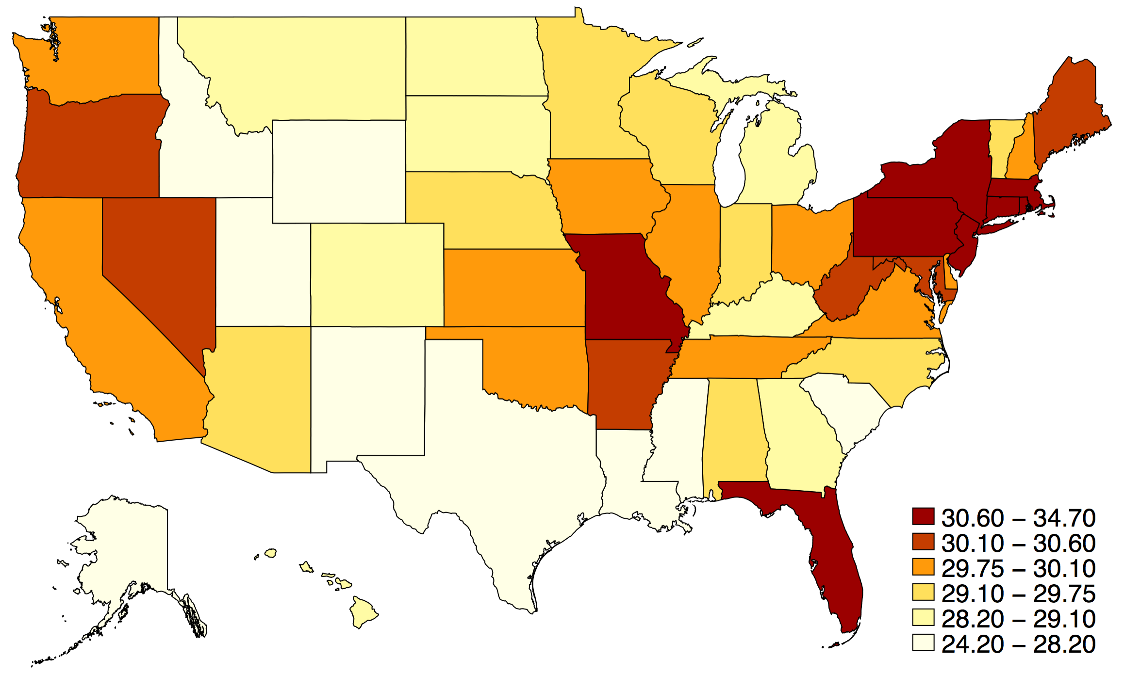
Stata has limited mapping abilities, but is able to produce simple maps. The main package for mapping in Stata is spmap, but you can add the package maptile for a slightly smoother process.
(Note: If you want to make publication-quality maps, we strongly encourage you to consider using a system that is designed for spatial work such as ArcGIS or qGIS. Data@Reed for more information about spatial analysis + mapmaking.)
Below is an example of maptile, using the built-in census dataset. This map shows median age, using state as the geographical "container" for visualization. The specifications in the spopt() command control where the legend is placed on the map (pos 4 = 4 o'clock; ring 1 = distance from the plot region.)
ssc install maptile
ssc install spmap
sysuse census
rename (state state2) (statename state)
maptile medage, geo(state) spopt(legend(pos(4) ring(1) ))
For more on spmap, see the user guide here. For more on maptile, refer to the maptile homepage.