London Part 1: Getting My Bearings
Getting My Bearings or, I assure you, Prof. Virginia Hancock, I did experience London, at least a little bit.
Distance and I have an exceedingly personal and quite visceral relationship. The spring and summer of 2014 saw me spend nine hours traveling fifty miles on foot, a few days touring several hundreds of miles on a bicycle, and five days crossing the mighty North American Continent by rail, among other things. It is in this context that I write that the thirteen hour ~5,000 mile flight across The Lake to London was pleasantly quick.
Immediately after clearing customs at Heathrow I collected my bicycle from the oversized luggage bin and made my way to a Transport for London ticket counter to purchase an Oyster Card—essentially, a swipe card that would enable me to use London’s buses, overground and underground trains. From there, I hopped a Piccadilly Line Underground train, “The Tube,” and made my way to central London.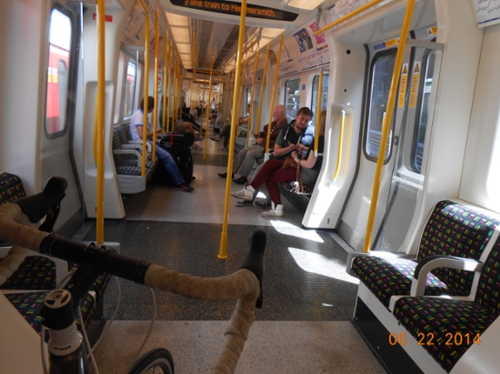 I had arranged to rent a room in a boarding house that catered specifically to researchers staying in London and afforded ready access to the National Archives, Kew Gardens, and the Natural History Museum. I found that such establishments were surprisingly common and much more affordable than hotels and even many hostels. The more you know.
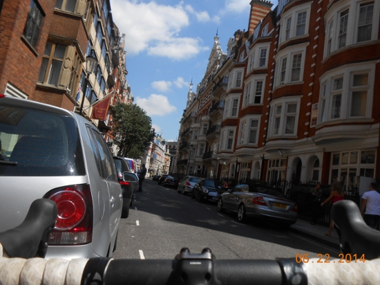
Navigating London was a disorienting experience. The city grew organically over many thousands of years. West Coast kids such as myself might be acutely attuned to the archaic urban geography of the place. Before this summer, the only cities that I had spent time in had been those designed according to grid systems and largely developed post-automobile. London, by stark contrast, was chalk full of windy narrow lanes, non-numbered, and unmarked streets. The index of street names alone took up the better part of my trusty London A-Z Atlas. I would be interested to see if there is any measurable difference in the spatial reasoning skills or cartographic awareness between the average Londoner and Westerner. Aboveground I had to play the part of the urban orienteer, making a concerted and constant effort to stay cartographically attuned. Underground, however, all such attention faded into the background, which, as I understand it, is kind of the point.
If you’ve ever sat on a Portland Max train, you’ve probably noticed the ingeniously simple, intuitive, and useful map of the Max lines displayed in the cars and around the stations. This map, along with countless other transit maps around the world, is modeled after the London Underground Transit Map designed by Harry Beck in 1931. Geographer Francis Harvey writes that “maps are representations that follow a number of principles and conventions that help deal with the complexity of the world.” Traditionally, these principles and conventions are dominated by considerations of directionality, angularity, the relative size of geographic areas, and the relative distance between points. Aboveground it’s good to know that Woodstock runs East-West, that Kenilworth City Park is near due North from my dorm room, that the area of Reed College is several times that of the before-mentioned park, and that the distance, as the crow flies, from my dorm to the Moreland Theater and from my dorm to Toast is about the same. All of these things I can ascertain by glancing at a street map that follows certain established principles and conventions which most of us have long since unconsciously internalized. The map of the London Underground, like the map in the Portland Max, dispenses with many of these principles and conventions.
When you’re traveling underground, from point to point, the aboveground concerns of the precise directionality, angularity, and even distance between points seem largely diminished. This is where Beck comes in, when in 1931 the unemployed draughtsman redrew the London Underground map into something resembling its current form. The map is, broadly construed, a lot like a circuit diagram. In the same way that the spatial arrangement of wires, resistors, inductors, etc. displayed on the diagram may not at all spatially correspond to the arrangement of the mess crammed into the inner workings of my blender, the map of the Underground need not spatially correspond to the confusing mess of tunnels below and windy streets above. Bill Bryson, in his Notes From A Small Island, points to some of the more humorous implications of Beck’s innovation:
Here's an amusing trick you can play on people from Newfoundland or Lincolnshire. Take them to Bank Station and tell them to make their way to Mansion House. Using Beck's map—which even people from Newfoundland can understand in a moment—they will gamely take a Central Line train to Liverpool Street, change to a Circle Line train heading east and travel five more stops. When eventually they get to Mansion House they will emerge to find they have arrived at a point 200 feet further down the same street, and that you have had a nice breakfast and done a little shopping since you last saw them. Now take them to Great Portland Street and tell them to meet you at Regent's Park (that's right, same thing again!), and then to Temple Station with instructions to rendezvous at Aldwych. What fun you can have! And when you get tired of them, tell them to meet you at Brompton Road Station. It closed in 1947, so you'll never have to see them again.
Although I spent a fair amount of time on the train, most of my experience of London as place came while in the saddle of a bicycle or running around the city, pushing out along the Thames River path and exploring central London’s many public parks. While on the train from the Heathrow airport, I overheard a tour guide telling a group of American high schoolers that traffic in central London moves about as fast now as it did in 1890—that is, traffic still moves at a gentlemanly horse and carriage pace. So I set out to beat the traffic and braved the morning commute on my bicycle, dodging in and out of the gentlemanly paced traffic while ignoring some of the perhaps not so gentlemanly tempered drivers. I had a fair bit of company. The sea change in environmental awareness over the past several decades combined with more recent British successes in events such as the Tour de France, I was told, had contributed to a surge in commuter cycling in London in particular, and recreational cycling in the UK in general. The aggressive riding style of many of the London bicycle commuters often resembled something uncomfortably similar to scenes from Lucas Brunelle’s documentary Line of Sight, which chronicles a series of alleycat bicycle races in cities around the globe, and took some getting used to. But as the saying goes, “when in Rome.”
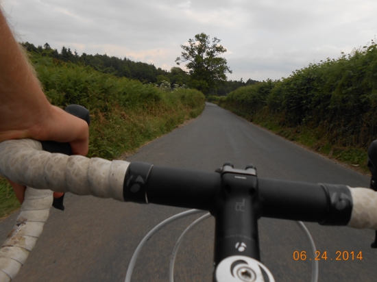 My travels not only led me to central London, where I worked at Kew Gardens, the National Archives, and the Museum of Natural History, but also to the English countryside when I spent the better part of a week traveling to the natural history museum in Tring, some 20 miles northwest of London. That commute in particular was by far my favorite (and tiring)—winding through the verdant green hills of the idyllic and preserved English countryside, past old stone fences and hedgerows, aged churches and an inn (“The Greyhound”), my reverie broken only by the occasional speeding Land Rover or BMW.
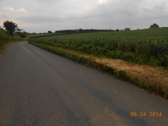
Tags: psf, presidents summer fellowship, london, transportation, the tube, maps