 |
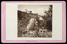
ca.1876. August Le Plongeon leaning against the central monolith ("la Picota"), which he "discovered".
Photograph by Alice Dixon Le Plongeon ca. 1876. Scanned from a high quality 35mm slide provided by the Getty Research Institute, taken from an original photograph in their collection. The image area of the photographs is ca. 3 1/2 x 3 7/8 inches. Reproduced with permission. Research Library, The Getty Research Institute, Los Angeles (2004.m.18-b12.89). |
|
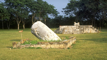 |
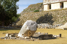
Square shrine with central
monolith ("la Picota"); Jaquar Throne beyond.
Jan. 2001 |
|
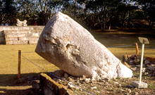 |
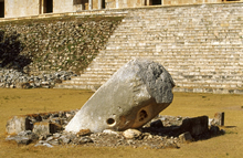
Central monolith in form
of inverted cone, badly tilted; presumably the surface
was once covered with stucco and painted with symbols and glyphs.
Jan. 2002 |
|
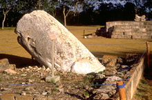 |
Central monolith,
badly tilted.
Jan. 2002 |
|
 |
Same shrine; when area near
shrine was excavated in 1953 by the INAH, they found bedrock
just below surface, indicating that Grand Platform was constructed
on top of a natural hill.
Jan. 2001 |
|
 |
Square shrine with central
monolith in form of inverted cone, badly
tilted; presumably surface once covered with stucco and painted
with symbols and glyphs.
Jan. 2001 |
|
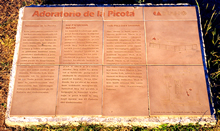 |
Official INAH plaque.
Jan. 2002 |
|
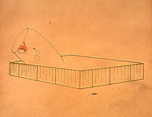 |
Detail of plaque at left;
drawing of tilted monolith in square shrine.
Jan. 2002 |
|
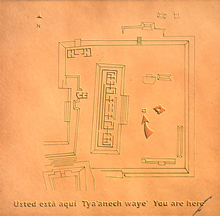 |
Detail of plaque at far-left;
groundplan of terrace on top of Great Platform; arrow indicates
location of square shrine ("la Picota").
Jan. 2002 |
|
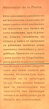 |
Spanish description.
Jan. 2002 |
|
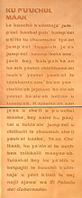 |
Yucatec Mayan description.
Jan. 2002 |
|
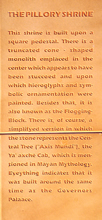 |
English description.
Jan. 2002 |
|