close window
click image to enlarge

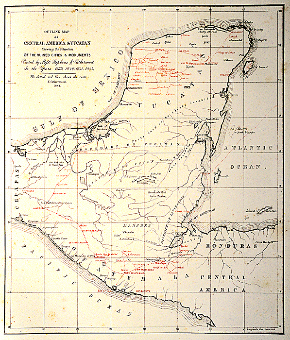
1844. Catherwood. "Outline Map of Central America & Yucatan, Shewing the Situation of the Ruined Cities & Monuments Visited by Messrs. Stephens & Catherwood. In the Years 1839, 1840, 1841, 1842. The dotted red line shews the route. F. Catherood. 1844."                                                                       
Print
in Frederick Catherwood, Views of Ancient Monuments in Central America, Chiapas, and Yucatan, 1844. Scanned from 35mm slides taken from the copy in the AMNH (RF-13-K). Reproduced Courtesy of The Library, Special Collections, American Museum of Natural History.