 |
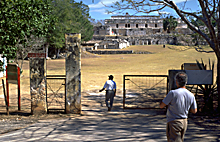
Modern gated entrance to
east portion of Kabah archaeological site; a modern highway cuts through the center of the ancient Maya city.
photo Jan. 2003 (24mm lens) |
|
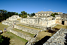 |
Ascending levels from lower plaza to upper Palace plaza.
photo Jan. 2003 (24mm lens) |
|
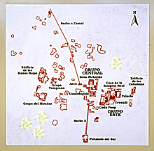 |
Posted map of Kabah with
major structures indicated (entire city including its residential areas
was much larger); map does not indicate modern entrances or
highway seen in photos at left).
photo Jan. 2002 |
|
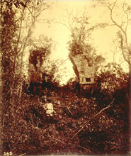 |
1888-1891. Partially
collapsed arch, north face; the largest freestanding arch
built by the Maya.
1888-1891 photograph by Henry N. Sweet as a member of the Thompson/Peabody expedition; scanned from 35mm slide of original photograph at Dumbarton Oaks. Reproduced Courtesy of the Peabody Museum of Archaeology and Ethnology, Harvard University. |
|
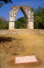 |
2001. Same arch as in photo at
left, south face, extensively restored; official INAH plaque
in foreground.
photo Jan. 2001 |
|
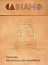 |
Detail of INAH plaque in
photo at left; north face; dotted lines indicate restored
portions and probable design of roofcomb.
photo Jan. 2001 |
|
 |
Looking north from arch in
photos above, along sacbé,18 kilometers (11
miles) to near Uxmal.
photo Jan. 2001 |
|
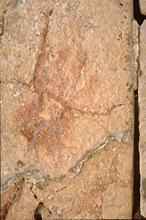 |
Print of red hand on inner
face of arch in photos above.
photo Jan. 2001 |
|
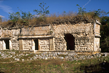 |
Temple of the Columns, front
facade; showing typical concrete rubble core, with many facing stones fallen, some remaining.
photo Jan. 2001 |
|
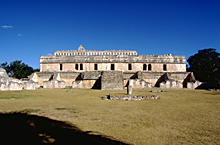 |
Palace, main (west) facade.
photo Jan. 2003 (24mm lens) |
|
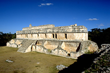 |
Palace, partly restored;
vaults and front facades of ground level front rooms partly
collapsed.
photo Jan. 2003 (24mm lens) |
|
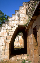 |
Detail of Palace in photo
at left; showing half vault under "flying staircase".
photo Jan. 2002 |
|