 |
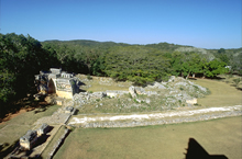
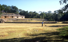
Sacbé leading
to Central Plaza at left, seen from top of Pyramid
Temple (El Mirador).
Jan. 2003 (24 mm lens) |
|
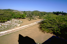 |
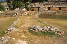
Central section of sacbé,
seen from top of Pyramid Temple (El Mirador).
Jan. 2003 (24 mm lens) |
|
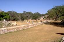 |
Raised sacbé, leading to Palace at right;
restored 1991-1992.
Jan. 2003 (24 mm lens) |
|
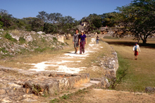 |
Raised sacbé,
figures approaching Central Plaza.
Jan. 2003 (24 mm lens) |
|
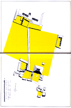 |
"Labna, Yucatan, Mexico". Site plan with central plaza and courtyards in yellow.
Scanned from George F. Andrews, Maya Cities, Placemaking and Urbanization, 1975 (fig. 248). Reproduced with permission of the University of Oklahoma Press. |
|
 |
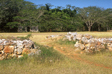
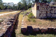
Showing width of sacbé,
stone retaining walls at sides, with rubble fill and
plaster surface.
Jan. 2001 |
|
 |
At far right is a modern cross-walk cut through
sacbé.
Jan. 2001 |
|
 |
Service and tourist cross
walk through sacbé.
Jan. 2001 |
|
 |
Trench between raised sacbé
at left and low building platform at right, looking south
to Central Plaza.
Jan. 2003 (24 mm lens) |
|