 |
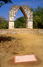
Largest freestanding
arch built by the Maya, south side; much reconstructed 1953-55, compare print and photographs bottom row.
Jan. 2001 |
|
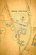 |
Detail of 1968 INAH map; north at top,
arch and sacbé at upper left.
Jan. 2002 |
|
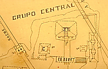 |
Detail of 1968 INAH map,
arch and sacbé at left
Jan. 2002 |
|
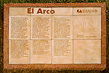 |
Official INAH plaque in photo
above.
Jan. 2001 |
|
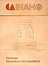 |
Detail of plaque at left;
elevation diagram, dotted lines indicate reconstructed portion
and hypothetical design of roofcomb.
Jan. 2001 |
|
 |
Detail of plaque at far left; description in English.
Jan. 2001 |
|
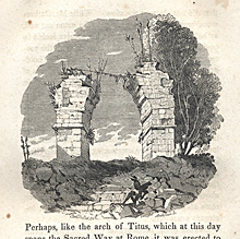 |
1843. NORTH side of Arch; drawn by Catherwood,
with assistance of daguerreotype and camera lucida.
Scanned from Stephens and Catherwood, Incidents of Travel
in Yucatan, 1843; closely based on Frederick Catherwood’s 1841-42
on-site drawing. |
|
 |
1888-91. NORTH side of Arch (cf.print at left from 40 plus years
previous).
1888-1891 photograph by Henry N. Sweet as a member of the Thompson/Peabody expedition; scanned from 35mm slide of original photograph at Dumbarton Oaks. Reproduced Courtesy of the Peabody Museum of Archaeology and Ethnology, Harvard University. |
|
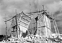 |
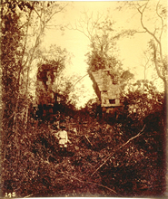
1953-55. SOUTH side of Arch, under reconstruction.
1953-55 photograph; scanned from 35mm slide taken of original photo. Reproduced Courtesy of The Division of Anthropology, American Museum of Natural History. |
|