 |
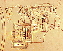
Detail of East Group in 1968 INAH map;
Lower Plaza is in area marked "14". The ground slopes down
toward modern highway at left. North at top of map.
Jan. 2002 |
|
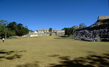 |
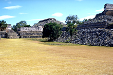
Looking from entry to Lower
Plaza, Palace Plaza, and Palace beyond. Such a long, major, east-west
cross-axis such as this one at Kabah is unusual for Puuc cities.
Jan. 2003 (24mm lens) |
|
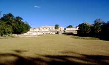 |
Closer-up view of photo at left; looking to Lower Plaza, Palace
Plaza, and Palace beyond.
Jan. 2003 (24mm lens) |
|
|
|
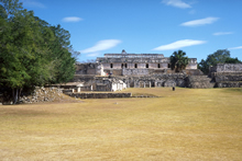 |
Closer-up view of area in photos above; looking to Lower Plaza with
altar in center and, at right, stairs to Palace Plaza.
Jan. 2001 |
|
 |
View to right of photo at left. Stairs to Palace
Plaza, Codz Poop Platform at right.
Jan. 2001 |
|
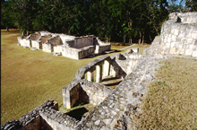 |
Looking down from Palace Plaza to Lower Plaza,
showing partially reconstructed buildings along north and east
sides of Lower Plaza.
Jan. 2003 (24mm lens) |
|
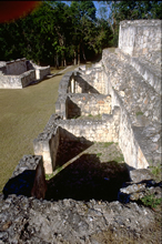 |
Same structures as in photo at left, showing especially the rooms of structure at east
end of Lower Plaza, against platform wall of Palace Plaza.
Jan. 2003 (24mm lens) |
|
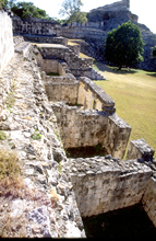 |
Same rooms as in photo at left, looking the opposite direction.
Jan. 2003 (24mm lens) |
|