 |
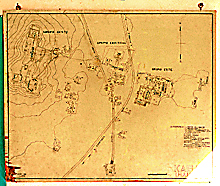
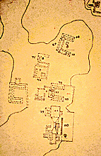
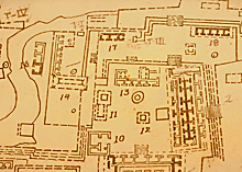
Original of official INAH,
1968, hand drawn map of Kabah, posted on wall of ticket office; north at top.
Jan. 2001 |
|
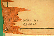 |
Inscribed "ENERO [January]
1968 / J. E. COBA"; the surface of board chipping off.
Jan. 2002 |
|
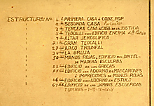 |
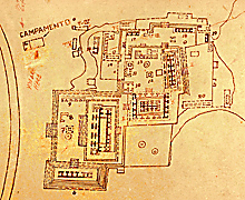
Numbered list of the major
structures at Kabah.
Jan. 2002 |
|
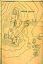 |
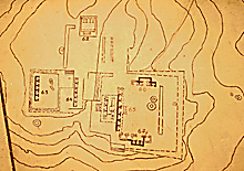
West Group; detail of map
above.
Jan. 2001 |
|
 |
Detail of West Group section at left, showing minor structures at lower
right of West Group.
Jan. 2002 |
|
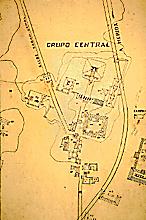 |
Central Group with sacbé toward Uxmal,
Arch, and Great Pyramid, on west side of highway; modern highway "A MERIDA" at right, shown cutting through archaeological
site.
Jan. 2001 |
|
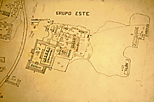 |
East Group; modern highway, at left,
cuts through the archaeological site. Codz Poop and Palace in center; Temple of the Columns
at far right.
Jan. 2001 |
|
 |
Close-up of East Group image at left, including Codz
Poop, Palace, etc.
Jan. 2002 |
|
 |
Close-up of East Group image at left; Palace at right.
Jan. 2002 |
|
 |
Detail of West Group. The
two stone doorjambs now in the Museum of Natural History in
New York were taken from the structure marked 67.
Jan. 2002 |
|
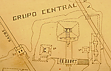 |
Central Group on west side of modern highway; showing sacbé and Arch at left, Great Pyramid
at center.
Jan. 2002 |
|
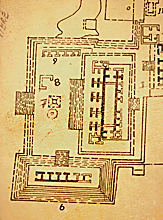 |
East Group; detail showing Codz Poop
with its terrace on the Great Platform and Structure 2B3
at bottom.
Jan. 2002 |
|